- 2011 Subaru Legacy and Outback Navigation System Owners Manuals
- Subaru Legacy and Outback Navigation System Owners Manuals
- 2009 Subaru Legacy and Outback Navigation System Owners Manuals
- Subaru Legacy and Outback Navigation System Owners Manuals
- 2008 Subaru Legacy and Outback Navigation System Owners Manuals
- Subaru Legacy and Outback Navigation System Owners Manuals
- 2006 Subaru Legacy and Outback Navigation System Owners Manuals
- Subaru Legacy and Outback Navigation System Owners Manuals
- 2012 Subaru Legacy and Outback Navigation System Owners Manuals
- Subaru Legacy and Outback Navigation System Owners Manuals
- 2010 Subaru Legacy and Outback Navigation System Owners Manuals
- Subaru Legacy and Outback Navigation System Owners Manuals
- Download PDF Manual
-
This button is used to display the menu screen.
This button is used to display the information screen.
20 Navigation
(3
(4
(10)
(11)
(5)
(6)
(7)
[VOL / POWER] This button is used to turn the system on or off.
This button is used to display the SCREEN function in which setting adjustments can be made to the screen.
[MAP DISC EJECT] This button is used to eject a map disc for the navigation sys- tem.
Legacy_B2462BE-A.book Page 21 Wednesday, April 22, 2009 5:32 PM
(8)
This button is used to revert all settings performed on the system to the default settings. This button is located on behind the map disc slot cover.
(9) Map disc drive loading slot
Insert a map disc here.
(10) Display screen
Multi function screens appear here.
(11)
This button is used to enter the voice recognition mode.
Navigation System Controls
Navigation 21
Legacy_B2462BE-A.book Page 22 Wednesday, April 22, 2009 5:32 PM
Map Disc Loading
When changing the map disc with a disc that is appropriate to the cur- rent location, or when updating the map disc while in the version upgrade of a map disc, it is necessary to change it with another map disc by following the procedure described below.
NOTE • When changing a map disc with another one, be sure to stop the vehicle in a
safe location.
• For details of the map discs, see "Map Discs". (See Page 49.)
1 With the ignition switch on, open the cover of the map
disc slot.
NOTE Support the upper side of the cover with your thumb, pull the notch located on the center of the under side of the cover, and then remove the cover.
22 Navigation
2 Press the map disc eject button. 3 When the map disc is ejected, take it out. 4 Insert a map disc that contains the area showing the cur-
rent position. The monitor automatically returns to the normal condition to start the loading of the disc.
CAUTION
• You must insert the map disc into the second slot from
the top.
• When inserting a map disc, do not insert 2 or more map
discs together. This may cause the mechanism to mal- function.
Legacy_B2462BE-A.book Page 23 Wednesday, April 22, 2009 5:32 PM
Starting Up the Navigation System
Use the following procedure to start up the navigation system and dis- play the current map screen.
1 Start the engine. 2 Press the [VOL/POWER] button while the system is off.
The CAUTION screen will appear, followed by the opening screen.
NOTE • When the system is started, a loading status bar will appear on the screen
while the system loads the programs from the map disc.
• When the system is started without the map disc loaded, the functions of the
system will be restricted.
3 Carefully read the instructions on the CAUTION screen
(shown below), then select
(agree).
CAUTION
Make selections only when vehicle is stopped. Watching screen while driving can lead to a serious accident. Some map data may be incorrect. Use judgment and obey traffic rules. See Owner's Manual for complete operating instructions.
NOTE • The CAUTION screen remains on the display unless you select
(agree).
• Selecting the
button allows you to change the language displayed
in the navigation system. (See Page 72)
Navigation 23
Legacy_B2462BE-A.book Page 24 Wednesday, April 22, 2009 5:32 PM
Starting Up the Navigation System 4 The current map screen will appear.
To make a selection, touch the desired key that is displayed on the screen.
NOTE • When you use the navigation system for the first time, Central Time will be displayed. Adjust the system's clock to the local time using the clock setting screen ("SET CLOCK") described on Page 74.
24 Navigation
Legacy_B2462BE-A.book Page 25 Wednesday, April 22, 2009 5:32 PM
Voice Guidance Volume
Use this function if you want to change the voice guidance volume setting from the default setting. 1 Press the
button.
2 Select
or
to adjust the sound volume.
• Each time Each time
is selected, the sound volume decreases. is selected, the sound volume increases.
•
If you want to turn off the sound of the navigation sys- tem, select
to display "OFF".
• To make sure the volume level, select
Navigation 25
Legacy_B2462BE-A.book Page 26 Wednesday, April 22, 2009 5:32 PM
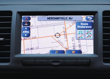
Markers and Controls Displayed on Maps
Screens During Route Setting Touch a point on the map. A crosshair (scroll mark) will appear on the screen. Then touch a desired point on the map. The map will scroll with the selected point at the center.
(1) (2) (3)
(7) (4) (5) (6)
(10)
(11)
(8)
(9)
26 Navigation
(1) Time
Indicates the current time.
(2) Map orientation control
Allows you to select either a "north up" display or "heading up" display of the map. (See Page 31.)
(3) GPS marker
Shows the status of the signal from GPS satellites. When this marker appears, the navigation system is receiving GPS sig- nals.
(4) Screen configuration control
Allows you to select a preferred display type for route guid- ance. (See Page 51.)
button to
Press return to the current map screen.
Scroll the map
(5) Map scale
Displays the map scale.
(6) Zooming control
Use Select
or
or
to zoom out or zoom in the map.
to select the map scale. (See Page 32.)
(7) Vehicle position marker
Indicates the current vehicle position and direction.
Legacy_B2462BE-A.book Page 27 Wednesday, April 22, 2009 5:32 PM
(8)
"Store memory point" key Stores the marked position on the map as a memory point.
(9) Point of interest (POI) key
Allows you to display the POI selection screen (See Page 87). On the screen, you can program POIs to appear on a map as markers.
(10) Distance from current position
Indicates the distance from the current vehicle position to the position marked by
(11) Destination/waypoint key
Programs a destination or waypoint at the position marked by
on a scroll screen.
Markers and Controls Displayed on Maps
Navigation 27
Legacy_B2462BE-A.book Page 28 Wednesday, April 22, 2009 5:32 PM
Markers and Controls Displayed on Maps
Screens During Route Guidance
(2)
(3)
(1)
(6)
(5)
(4)
(5 seconds)
Select the screen (Touch a point on the screen)
(7)
(8)
28 Navigation
(1) Distance and time to destination
Indicates the time (either approximate time required or esti- mated time of arrival) and the distance to the destination or a waypoint.
(2) Route
Indicates the route guide with blue line.
(3) Turn guidance arrow
Indicates the direction of your turn at the next intersection/ intersection as well as the distance to the intersection/inter- section.
(4)
"Repeat voice guidance" key Repeats the last voice guidance.
(5) Current road name
Shows the name of the road you are currently driving on.
(6)
"Display whole route" key Displays a map containing the entire route. (See Page 64.)
(7) Detour
Calculates an alternative route that detours from the current location.
(8)
"Change route" key Displays the route option menu. Selecting a new route option causes the system to calculate the selected route.
Legacy_B2462BE-A.book Page 29 Wednesday, April 22, 2009 5:32 PM
Menu Screen Keys and Functions
Select to return to the current map screen.
Press play the menu screen.
button to dis-
The table below shows the keys displayed on the NAVI MENU screen, the functions accessible by selecting these keys, and the pages of this manual that describe the instructions you should fol- low when using these functions.
Menu screen key Stored Locations
Navigation Set Up
Route Options
Reference page Function page 78
Memory Points page 83
Avoid Area page 85
Previous Dest. page 69
User Settings page 71
Quick POI Selection page 72
Language Selection page 73
Calibration page 74
Set Clocks Vehicle Signal page 75
Restore System Defaults page 75
page 58
Search Condition page 59
Detour page 60
Route Pref. Dest. & Way Point page 60
page 64
Display Route Route Preview page 65Navigation 29
Legacy_B2462BE-A.book Page 30 Wednesday, April 22, 2009 5:32 PM
Menu Screen Keys and Functions
Menu screen key Phone
Version
Function Bluetooth Phone Redial List Received Calls Phone Book Memory Points Bluetooth Settings Version
Reference page page 240
page 259
page 259
page 261
page 250
page 252
page 96VOL
Voice guidance volume
page 25
30 Navigation
Legacy_B2462BE-A.book Page 31 Wednesday, April 22, 2009 5:32 PM
Map Operations
Selecting Map Orientation
You can select either "heading up" or "north up" display on the current map screen by using the following procedure. 1 Select
or
<"North up" display>
If you select map so that north is always directly upwards on the screen.
("north up" display), the system rotates the
<"Heading up" display> If you select map so that the direction in which you are heading is always directly upwards on the screen (note that the red arrow points to the north).
("heading up" display), the system rotates the
Navigation 31
Legacy_B2462BE-A.book Page 32 Wednesday, April 22, 2009 5:32 PM
Map Operations
Changing Map Scale
You can increase or decrease the scale of the map using the following procedure: 1 Select
to change the map scale.
or
2 Selecting
below.
or
changes the scale as shown
32 Navigation
Legacy_B2462BE-A.book Page 33 Wednesday, April 22, 2009 5:32 PM
Map Operations
NOTE • Briefly touching • Touching • Selecting either of the following on the scale bar displayed by
allows you to change the map scale.
for a long time allows you to change the map scale.
or
or
selecting
or
allows you to change to the specified map scale.
Scale to be changed
Current scale
Imperial display Metric display
1/32 mi (mile) 50 m
1/4 mi (mile) 500 m
2 mi (mile) 4 km
16 mi (mile) 32 km
128 mi (mile) 256 km
• The scale can be displayed in Imperial or metric units. To change the units, See
Page 69.
Navigation 33
Legacy_B2462BE-A.book Page 34 Wednesday, April 22, 2009 5:32 PM
Setting Route
Setting Destination Setting destination/waypoints by scrolling the map
Even if you do not know the exact address of your destination or a way- point on your route to the destination, you can set it by scrolling the map as follows: 1 Touch the screen and scroll the map until the crosshair
reaches the destination or a waypoint.
2 Select the
(destination or waypoint) key.
The key will separate into the destination key and the waypoint key.
3 Select
for setting the destination
The system will calculate the route and display the entire route to the destination on the map.
34 Navigation
for a waypoint. The system will program the
Select address of the waypoint on your route. (See Page 60.) You can set up to 5 waypoints per trip.
Legacy_B2462BE-A.book Page 35 Wednesday, April 22, 2009 5:32 PM
4 Select
(start).
Route guidance will begin along the displayed route.
NOTE • If the system cannot find the desired route, select
(change
route). This will allow you to access the ROUTE OPTIONS screen, from which you can prompt the system to calculate a new route. (See Page 57.)
• Selecting
(start) for more than 5 seconds will start the demon-
stration mode operation.
Setting Route
■ Selecting route Upon setting the destination, the system prepares to calculate three types of routes to the destination (Quick, Alt., and Short). You can select from any of the three options as follows: 1 Select
(3 routes).
The system will be ready for calculation of any route you select from the three options, namely, Quick (the fastest route), Alt. (alternative route), and Short (the shortest route).
Navigation 35
Legacy_B2462BE-A.book Page 36 Wednesday, April 22, 2009 5:32 PM
Setting Route 2 Select
(information).
The screen will display details (required time, total distance, roads used, etc.) regarding each option.
3 Select
(Quick),
(Alt.),
or as you desire, and then select firm your selection.
(Short) (Start) to con-
Setting destination from the navigation menu
You can set the destination using a variety of categories if you start set- ting from the DESTINATION ENTRY screen. Before you can use any of these categories, perform the following steps: 1 Press the 2 Select the desired search category.
button.
36 Navigation
Legacy_B2462BE-A.book Page 37 Wednesday, April 22, 2009 5:32 PM
(Address)
(Point of Interests)
(Select from Map)
(Emergency)
(Memory Point)
See Page 38.
See Page 41.
See Page 43.
See Page 44.
See Page 40.
(Previous Destination)
See Page 42.
(Intersection)
(Freeway Ent/Exit)
(Phone number)
(Coordinates)
(Home)
See Page 46.
See Page 43.
See Page 48.
See Page 45.
See Page 40.
(Preset1) - (Preset5)
You can switch between screens by selecting or
(previous page).
(next page)
NOTE • If the set destination area is different from the one displayed under "Search
Area" in the right part of the screen, you must select the key and specify the desired area again.
(change)
• Depending on the category used or the status of the map displayed, the
point that is located may differ from the location where the facility you want to visit actually exists.
Setting Route
Navigation 37
Legacy_B2462BE-A.book Page 38 Wednesday, April 22, 2009 5:32 PM
Setting Route
■ "Address" category 1 Press the 2 Enter a house number using the keypad on the house
button and select
(address).
number input screen and select
You can switch between keypad screens showing different characters (alphabet). by selecting
(symbols) or
(others),
4 Select the desired street from the list.
If the same street name exists in more than one city, a list of these towns will be shown.
3 Enter the street name and select
(list).
5 Select the correct town from the list.
: Use this key to delete the last character entered. Select it repeatedly if you want to delete all the characters entered.
38 Navigation
Legacy_B2462BE-A.book Page 39 Wednesday, April 22, 2009 5:32 PM
6 Select
(destination) to set the address entered
in the above steps as the final destination. The system will calculate the route and display the entire route on the map.
(waypoint) to set the address entered in the
Select above steps as a waypoint on your route. You can program up to five waypoints per trip.
7 Select
(start).
Route guidance begins along the displayed route.
NOTE • If the system cannot find your desired route, select
Setting Route
(change
route). This will allow you to access the ROUTE OPTIONS screen, from which you can prompt the system to calculate a new route. (See Page 57.)
• If the map disc does not contain the relevant house number data, an error message will be displayed and a street map will appear, allowing you to set the destination using the map disc.
• If the destination is not on a road, set a destination point on a main road near-
est to the actual destination.
• Selecting the on a city basis.
(city) will display a screen that searches the destination
: Search the destination from all cities. : Search the destination from the nearby five cities from the current position. : Search the destination by inputting the city name. : You can also search the destination from the five cities that you searched in the past.
Last 5 cities
Navigation 39
Legacy_B2462BE-A.book Page 40 Wednesday, April 22, 2009 5:32 PM
Setting Route
■ "Memory Point" category If you have saved some locations in the system's memory, you can make use of an appropriate one to set the destination. 1 Press the
button and select
(memory
point). 2 Select
(list).
3 Select the desired location (memory point).
: Use this key to display up to five previous suggestions.
40 Navigation
: Use this key to display the previous suggestion.
: Use this key to display the next suggestion.
: Use this key to display up to five of the next suggestions.
NOTE • Select the
displayed.
(Attribute),
(icon),
(name), or
(date) key to change the sequence in which memory points are
• You cannot use the "Memory Point" method unless there are memory points
stored. To store memory points, See Page 78. 4 Select
(destination) or
(waypoint).
■ "Home" category or "Preset" category using stored des-
tinations
If you have stored the home address in the system's memory, you can use it for your destination or a waypoint. Similarly, if other locations are stored in the memory, they can be conveniently used for quick setting of destination and waypoints.
EN(Hokubei)_Legacy_02_Navi-a.fm Page 41 Friday, May 1, 2009 11:21 AM
1 First, choose either of the two procedures below to fol-
low the "home" category. Press the 2 Select through
button.
(Preset 5).
(home) or the preset keys
1 Press the
est).
button and select
(point of inter-
Setting Route
2 Enter the name of the desired point of interest and
(Preset 1)
select
NOTE
(home) and the preset keys
(Preset 5) are displayed only when you have stored the home location and other loca- tions in the memory. 3 Select
(destination) or
(Preset 1) through
(waypoint).
The map including the home location or the selected location will be displayed.
■ "Point of Interest" category You can use a selection from the "Point of Interest" listing as the desti- nation or a waypoint.
: Use this key to delete the character last entered. Select it repeatedly if you want to delete all of the characters entered.
NOTE During character entry, the system shows the point of interest list automatically when the amount of matching points of interest is four or less.
Navigation 41
Legacy_B2462BE-A.book Page 42 Wednesday, April 22, 2009 5:32 PM
Setting Route 3 Select the desired point of interest from the list.
1 Press the
button, select
, and then
select
(previous destination).
2 Select a desired location from the Previous Destination
list.
: Use this key to display up to five previous suggestions.
: Use this key to display the previous suggestion.
: Use this key to display the next suggestion.
: Use this key to display up to five of the next suggestions.
:Use this key to display up to five previous suggestions.
NOTE • If two or more points of interest share the same name, they will both be listed
on the screen. Choose an appropriate one from the list.
• If there are two or more points of interest with the same name, (City) to shorten the list.
(category) or
select
• Displayed information about a specific facility might not include recent
changes. It is recommended that you check the location or business days/ hours of a desired point of interest before departure. 4 Select
(destination) or
(waypoint).
■ "Previous Destination" category This method allows you to choose one of the most recently used 100 destinations or waypoints as the new destination or waypoint.
42 Navigation
: Use this key to display the previous suggestion.
: Use this key to display the next suggestion.
: Use this key to display up to five of the next suggestions.
NOTE • You can select
(name) or
(date) to change the
sequence in which previous destinations are displayed.
• Selecting
previous route guide. 3 Select
displays the start point of the
(destination) or
(waypoint).
Legacy_B2462BE-A.book Page 43 Wednesday, April 22, 2009 5:32 PM
■ "Select from Map" category You can specify a location on the map that was last displayed and use it for setting the destination or a waypoint. 1 Press the
button and select
(select from
map).
2 Scroll the map until the crosshair
destination or waypoint.
is at the desired
3 Select
(destination) or
(waypoint).
2 Enter the name of the desired freeway and select
Setting Route
: Use this key to delete the character last entered. Select it repeatedly if you want to delete all of the characters entered.
NOTE During character entry, the system shows the freeway name list automatically when the amount of matching freeways is four or less. 3 Select the name of the freeway from the list.
■ "Freeway Entrance/Exit" category You can use the name of a Freeway entrance or exit selected from the "Freeway Ent./Exit" list for setting the destination or a waypoint. 1 Press the
, and then select
button, select
(Freeway Ent./Exit).
: Use this key to display up to five previous suggestions.
: Use this key to display the previous suggestion.
Navigation 43
Legacy_B2462BE-A.book Page 44 Wednesday, April 22, 2009 5:32 PM
Setting Route
: Use this key to display the next suggestion.
: Use this key to display up to five of the next suggestions.
4 Select
(entrance) or
(exit).
: Use this key to search through the list by name (alphabeti- cal search)
6 Select
(destination) or
(waypoint).
■ "Emergency" category This function allows the nearest police station or hospital to be set as the destination. 1 Press the 2 Select either
button and select
(emergency).
(Police sta-
5 Select the name of the street from which you will enter the freeway or to which you will go after leaving the free- way.
tion) or The nearest police stations or hospitals will be displayed accord- ingly.
(Hospital).
: Select this key before you can enter the street name.
: Use this key to search through the list by distance.
44 Navigation
Legacy_B2462BE-A.book Page 45 Wednesday, April 22, 2009 5:32 PM
3 Select the desired institution from the list.
: Use this key to display up to five previous suggestions.
: Use this key to display the previous suggestion.
: Use this key to display the next suggestion.
: Use this key to display up to five of the next suggestions.
: Sorts the list by distance.
: Sorts the list in alphabetical order by name.
4 Select
(destination) or
(waypoint).
NOTE Displayed information about each facility might be changed. It is recommended that you check the location or business days/hours before departure.
Setting Route
■ "Coordinates" category You can set destinations or waypoints using their latitudes and longi- tudes as follows: 1 Press the
, and then select
button, select
(coordinates).
2 Enter the latitude of the desired location.
Use the numeric keys together with the [°] (degrees), ['] (minutes), and ["] (seconds) keys.
: Use this key to delete the character last entered. Select it repeatedly if you want to delete all of the characters entered.
Navigation 45
Legacy_B2462BE-A.book Page 46 Wednesday, April 22, 2009 5:32 PM
Setting Route 3 Enter the longitude of the location.
5 Select
(destination) or
(waypoint).
■ "Intersection" category You can use a intersection defined by two street names as a location for setting your destination or a waypoint. 1 Press the
button, select
, and then
: Use this key to switch over to the north latitude.
: Use this key to switch over to the south latitude.
: Use this key to switch over to the west longitude.
: Use this key to switch over to the east longitude.
: Use this key to delete the character last entered. Select it repeatedly if you want to delete all the characters entered.
4 Select
(OK).
select
(Intersection).
2 Enter the name of the first street and then select
: Use this key to delete the character last entered. Select it repeatedly if you want to delete all of the characters entered.
NOTE During character entry, the system shows the street name list automatically when the amount of matching streets is four or less.
46 Navigation
Legacy_B2462BE-A.book Page 47 Wednesday, April 22, 2009 5:32 PM
3 Select the street from the "Intersection" list.
Setting Route 5 When there are two or more candidates, a list of intersec- tions will be displayed. Select an intersection of the des- tination.
: Use this key to display up to five previous suggestions.
: Use this key to display the previous suggestion.
: Use this key to display the next suggestion.
: Use this key to display up to five of the next suggestions. 4 Specify the second street using the same procedure as
the first street. Select
(List).
NOTE No intersection is defined if • the two streets do not cross each other, • the two streets are a freeway and a highway, • either street is for right or left turns only, • both are one-way streets, • either street is for U-turns, • the two streets cross on the inside lane, • either street is an on/off ramp, and/or • either street is a frontage street. 6 Select
(destination) or
(waypoint).
Navigation 47
Legacy_B2462BE-A.book Page 48 Wednesday, April 22, 2009 5:32 PM
Setting Route
■ "Phone number" category This function allows buildings and the like to be located using their phone numbers. 1 Press the
, and then select
button, select
(phone number).
2 Enter the phone number starting with the area code.
: Use this key to delete the character last entered. Select it repeatedly if you want to delete all of the characters entered.
48 Navigation
3 Select
4 Select your destination.
NOTE If a number of candidates exist as a result of, for example, different area codes, these will be displayed in a list. The desired destination can then be selected from the list. 5 Select
(destination) or
(waypoint).
Legacy_B2462BE-A.book Page 49 Wednesday, April 22, 2009 5:32 PM
■ Using "Change Search Area" function This function designates a general geographical area where the desti- nation or waypoint you want to set is located. 1 Press the 2 Select the desired area.
button and select
(change).
Setting Route
■ Map Discs The three map discs contain different areas, respectively. (West, Mid and East) Select the map disc containing the destination area you wish and insert the disc in the navigation system. Make sure to reselect the destination when changing the map disc. Refer to the section Set Route in the Instruction Manual for instructions on reselecting the destination.
The DESTINATION ENTRY menu screen will appear.
■ Area (West)
NOTE • The SEARCH AREA screen shown above is a sample image. It may be slightly
different from the actual screen image.
• Three map discs are contained in this system. When performing a search for a
different area in your destination search, it is necessary to change the map disc with another map disc. If an area you want to find is not displayed on the screen shown above, take out the map disc and change it with a map disc containing the relevant area. For details of the map disc, refer to the description below.
Arizona, California, Colorado, Idaho, Kansas, Montana, Nebraska, Nevada, New Mexico, North Dakota, Oklahoma, Oregon, South Dakota, Texas, Utah, Washington, Wyoming, Canada
Navigation 49
NOTE • Road information for all of the above locations is included on the map discs.
This means that the following operations can be performed regardless of which map disc is loaded in the system; - Scrolling Map to Select Destination (Select from Map) - Selecting Destination from the previously registered points as a memory point (Home, Memory Point, Previous Destination) within the same area.
- Selecting Destination by Latitude and Longitude (Coordinates), Phone num-
ber, Emergency, and Quick POI.
• After replacing the map disc, stored data including the POI icon on the map and stored Avoid Street settings will be deleted, and Quick POI selections will return to default.
• In the Current Location display, the arrival time and the distance to the desti-
nation are displayed for Next Way Point.
Legacy_B2462BE-A.book Page 50 Wednesday, April 22, 2009 5:32 PM
Setting Route
■ Area (Mid)
Alabama, Arkansas, Illinois, Indiana, Iowa, Kansas, Kentucky, Louisiana, Michigan, Minnesota, Mississippi, Missouri, Nebraska, North Dakota, Ohio, Oklahoma, South Dakota, Tennessee, Texas, Wisconsin, Canada
■ Area (East)
Alabama, Connecticut, Delaware, Florida, Georgia, Kentucky, Maine, Massachusetts, Maryland, New Hampshire, New Jersey, New York, North Carolina, Ohio, Pennsylvania, Rhode Island, South Carolina, Tennessee, Vermont, Virginia, Washington D.C., West Virginia, Canada
50 Navigation
EN(Hokubei)_Legacy_02_Navi-a.fm Page 51 Friday, May 1, 2009 11:28 AM
Route Guidance
Route Guidance Screen
During route guidance, the system can indicate on a second screen the directions in which you must make turns at the next and following intersection in either of two ways: "turn arrow" or "turn list". Specify your preferred method of indica- tion as follows:
1 Select 2 Select
(screen configuration).
for turn arrow indication or
for turn list
indication. If you do not need to make any further selections, select The displayed keys will be hidden.
Turn direction is indicated by an arrow.
Turn directions are indicated in a list.
Navigation 51
NOTE Use the following procedure to recall the most recently displayed zoom-in map of an intersection or a freeway fork. 1. Select 2. Select
(screen configuration). (re-display of intersection/range guidance). If you do not need to make any further selections, select keys will be hidden.
. The displayed
EN(Hokubei)_Legacy_02_Navi-a.fm Page 52 Friday, May 1, 2009 11:28 AM
Route Guidance
Zoom-in Map at Intersection
Before you arrive at an intersection, the system will automati- cally show a zoom-in map of the intersection on a second screen to make the guidance clearer.
As you approach an intersection during route guidance, a zoom-in map of the intersection automatically appears on a second screen. After you drive past the intersection, the zoom-in map disappears.
As you approach a fork on a freeway during route guidance, a zoom-in map of the freeway automatically appears on a second screen, making the route guidance clearer.
52 Navigation
Legacy_B2462BE-A.book Page 53 Wednesday, April 22, 2009 5:32 PM
Dual Map Display
You can configure the screen for a dual map display.
2 Select
(dual map).
Route Guidance
1 Select
(screen configuration).
If you wish to return to the single map display, select gle map).
(sin-
If you need not make any further selection, select vant keys will disappear.
. The rele-
NOTE If you wish to modify the display selections that have been made for a second screen, touch the top of the screen. After completing the modification, select • See Page 32 for details on scale changes. • See Page 87 for details on setting with
Navigation 53
Legacy_B2462BE-A.book Page 54 Wednesday, April 22, 2009 5:32 PM
Route Guidance
Freeway Information
A list of buildings and facilities along a freeway can be dis- played on the screen. 1 Select 2 Select
(screen configuration).
(freeway information).
If you need not make any further selection, select The relevant keys will disappear.
The information of a freeway is displayed.
54 Navigation
Select with the icons of hotels and banks.
to display the map in the neighborhood together
This map allows you to set the destination and waypoints. It also allows you to register them with the Memory Point with the cur- sor placed on the icon.
Legacy_B2462BE-A.book Page 55 Wednesday, April 22, 2009 5:32 PM
Replaying Voice Guidance
If you want to listen to the last voice guidance again during route guidance, use the following procedure: 1 Select
You can hear the voice guidance again.
Route Guidance
Navigation 55
Legacy_B2462BE-A.book Page 56 Wednesday, April 22, 2009 5:32 PM
Route Guidance
Compass Mode
Longitude and latitude of present location can be displayed on the screen. 1 Select
(screen configuration).
3 Longitude and latitude of present location are displayed
at upper right of the screen.
2 Select
(compass).
56 Navigation
Legacy_B2462BE-A.book Page 57 Wednesday, April 22, 2009 5:32 PM
Route Options
Setting Route Options
Using the functions available from the Route Options screen, you can change the route options, stop the route guidance or check the route. Use the following procedures: 1 Press the
button.
2 Select
(route options).
3 The Route Options screen will appear. Select any of the
following displayed functions as necessary:
(search condition):
This function allows you to specify the way in which the system calculates the route to the destination. (See Page 58.)
(detour):
This function allows you to prompt the system to calculates an alternative route from the current position within a specified dis- tance. (See Page 59.)
(route preferences):
This function allows you to prompt the system to alter the route search conditions and recalculate the route accordingly. (See Page 60.)
Navigation 57
Legacy_B2462BE-A.book Page 58 Wednesday, April 22, 2009 5:32 PM
Route Options
(destination and waypoint):
This function allows you to modify the destination and waypoints, and prompt the system to recalculate the route accordingly. (See Page 60.)
(display route):
This function allows you to confirm the entire route and, if neces- sary, prompt the system to recalculate the route according to your specification. (See Page 64.)
(route preview):
This function allows you to simulate a drive along the route that is calculated by the system before departure. (See Page 65.)
(calculate):
Selecting this key prompts the system to recalculate the route.
(cancel guidance):
Selecting this key prompts the system to stop route guidance. Note that this erases the destination and waypoints. To prompt the system to start guidance again, select
(calculate).
NOTE A recalculated route will sometimes be the same route as the one displayed before recalculation.
58 Navigation
Search condition
You can specify the way in which the system calculates the route. 1 Press the
button, then select
(route (search condition).
options), and then select
2 Select
(Quick),
(Alt.),
(Short) to specify the way of calculating the or route to reach the next waypoint or the destination from the current point.
: The system will calculate a route with the shortest
driving time required.
: The system will calculate an alternative route.
(You can select waypoint. Only second and subsequent waypoints.)
or
or
for the first can be specified for the
: The system will calculate a route with the shortest
driving distance.
Legacy_B2462BE-A.book Page 59 Wednesday, April 22, 2009 5:32 PM
3 Select 4 Select
(calculate)
(start).
Route guidance will begin along the displayed route.
Route Options
1 Press the
button, then select
(route
options), and then select
(detour).
2 Select a detour distance using
or The system will then calculate an alternative route that detours from the current location within the specified distance.
(whole route).
Detour
You can specify a detour distance from your current position. The sys- tem will calculate an alternative route according to the distance specifi- cation, enabling you to take a detour.
When driving on the freeway, make a selection from among
and
3 Select
(start).
NOTE If you are driving off the route, it is not possible to calculate a detour route.
Navigation 59
Destination and waypoints
You can change the destination or waypoints for the route calculation by using this function.
■ Addition of waypoints Use the following procedure to add new waypoints to the current route for recalculation. 1 Press the
button, then select
(route
options), and then select points). 2 Select
(destination and way-
(add).
Legacy_B2462BE-A.book Page 60 Wednesday, April 22, 2009 5:32 PM
Route Options
Route preferences
Use this function to specify preferred route search conditions. The sys- tem will start recalculating the route according to your specified condi- tions. 1 Press the
button, then select
(route
options), and then select
(route preferences).
2 Specify conditions by selecting keys.
Each time you select a key, it will toggle between "usage" and "non-usage" of the corresponding roads or ferries.
3 Select
(calculate).
NOTE • The (calculate) key can be selected during route guidance. • The route calculation will not always be able to follow the specified condi-
tions.
60 Navigation
Legacy_B2462BE-A.book Page 61 Wednesday, April 22, 2009 5:32 PM
3 Set a waypoint using any method available from the
screen.
Route Options
NOTE • When a new destination is set using
(destination), it will replace the
current destination and the route calculation will be carried out again.
• Step 4 must be performed for the second and any subsequent waypoints. • Repeat Steps 1 to 4 for each waypoint to be set.
4 Specify the order in which all the set waypoints are to be
visited. Choose the location of the waypoint to be added, and then select
(add).
5 Select
(calculate).
■ Modifying destination or waypoint positions Use this procedure to modify the destination or waypoint positions. The screen will display the calculated route and the positions of the destina- tion or waypoints that you will be able to modify. 1 Press the
button, then select
(route
options), and then select points). 2 Select 3 Select
(list).
(change location).
(destination and way-
Navigation 61
Legacy_B2462BE-A.book Page 62 Wednesday, April 22, 2009 5:32 PM
Route Options 4 Select the key corresponding to the location that is to be
modified. The map for the area around current location will be displayed.
5 Scroll the map to bring the crosshair
to the location
and then select
3 Select the waypoint keys according to the order of your
visit. If you wish to cancel the visiting order number indication, select
(undo).
6 Select
(calculate).
4 When you complete the sequencing, the visiting order
will be updated automatically.
■ Modifying visiting order You can change the order for visiting your waypoints by using this pro- cedure. 1 Press the
button, then select
(route
options), and then select points) 2 Select
(list).
62 Navigation
(destination and way-
5 Select 6 Select
(calculate).
Legacy_B2462BE-A.book Page 63 Wednesday, April 22, 2009 5:32 PM
■ Deleting destination or waypoints Use this procedure when you wish to delete the previously set destina- tion or waypoint. 1 Press the
button, then select
(route
4 Confirmation message will be displayed. Select
Route Options
(yes). Select
(no) to cancel the deletion.
(destination and way-
options), and then select points). 2 Select 3 Select the key corresponding to the destination or way-
(delete).
point you wish to delete.
5 Select
(calculate).
Navigation 63
Display route
Use this function to display the entire route. You can also specify an area you wish to avoid and prompt the system to recalculate the route accordingly. 1 Press the
button, then select
(route
options), and then select
(display route).
2 Select
(turn list).
The entire route screen will appear and then it will change to the Turn List screen.
Legacy_B2462BE-A.book Page 64 Wednesday, April 22, 2009 5:32 PM
Route Options
■ Deleting destination and all waypoints You can delete the destination and all previously set waypoints in a sin- gle process. 1 Press the
button, then select
(route
(destination and way-
options), and then select points). 2 Select 3 Confirmation message will be displayed. Select
(delete all).
(yes). Select
(no) to cancel the deletion.
64 Navigation
Legacy_B2462BE-A.book Page 65 Wednesday, April 22, 2009 5:32 PM
Route preview
Route Options
The system can show you an automated simulation of the calculated route. 1 Press the
button, then select
(route
options), and then select
(route preview).
2 Start the simulation drive according to the calculated
route using the keys on the screen as follows:
(avoid):
Select this key if you wish to specify any areas to avoid from the list of street names.
(Reroute):
The system will recalculate the route.
If the data for the route cannot be shown on one screen, scroll the screen using the
keys.
and
3 When the Reroute is selected: Select
(start).
: Move to the start point.
: The simulation drive will start toward the start point. After the
start, this key will be displayed as selected, the simulation drive will switch to high-speed driving.
, and when it is
: The simulation drive will stop.
: The simulation drive will start toward the destination. After the start, this key will be displayed as , and when it is selected, the simulation drive will switch to high-speed driving.
Navigation 65
Legacy_B2462BE-A.book Page 66 Wednesday, April 22, 2009 5:32 PM
Route Options
: Move to the destination.
: The EDIT ROUTE PREVIEW screen will be displayed. (See Page 66.)
NOTE The visual speed of the simulation vehicle varies with the map scale selected. The speed appears to be faster with a wide-area map than with a zoom-in map.
66 Navigation
■ Setting conditions for simulation drive You can change the simulation drive conditions using this procedure. 1 Press the
button, then select
(route
options), and then select
(route preview).
2 Select
(edit).
The EDIT ROUTE PREVIEW screen will appear.
(to destination or next waypoint):
The simulation drive will stop at the destination or the next way- point.
(to next POI):
The simulation drive will stop at a point of interest that has been set up on the route.
(delete):
A selected POI will be deleted.
EN(Hokubei)_Legacy_02_Navi-a.fm Page 67 Friday, May 1, 2009 2:26 PM
POI keys: When you select one of the six POI category keys, the system will retrieve the selected POI from the Quick POI storage and display it on the map. When selecting the (others) key, POIs of other categories can be found. For more details, see Page 71.
Route Options
If, for example, the key is selected and a simulation drive is started, the simulation vehicle will then stop at a restaurant on the route.
(to next POI) category
If you then select information on the restaurant.
(information), the system will display
Selecting number displayed. * The Bluetooth Phone is required to be set in advance.
allows you to make a phone call to the phone
NOTE You must finish the simulation drive before you actually start to drive. Although the simulation drive will automatically stop when you actually start to drive, not finishing it properly can lead to an error in the display of the current position of the vehicle.
Navigation 67
Select any of the displayed functions as necessary. This screen consists of two pages. Change the page by using the
keys.
or
Legacy_B2462BE-A.book Page 68 Wednesday, April 22, 2009 5:32 PM
Navigation Setup
Setting Navigation System
Using the functions available from the Navigation Setup screen, you can change the map display conditions and alter the route guidance conditions. 1 Press the
button.
2 Select
(navigation setup).
The NAVIGATION SET UP screen will appear.
68 Navigation
Legacy_B2462BE-A.book Page 69 Wednesday, April 22, 2009 5:32 PM
(user settings):
This function allows you to change the screen display and sound settings. (See Page 69.)
(quick POI selection):
This function allows you to set the point of interest categories that are displayed when selecting the menu from the current position screen. (See Page 71.)
(language):
This function allows you to change the language for the menu screens and the voice guidance. (See Page 72.)
(calibration):
You can use this function to correct display errors in the vehicle's position and direction. (See Page 73.)
(set clock):
This function allows you to set the time. (See Page 74.)
(Vehicle Signal):
This function allows you to confirm the vehicle signal, the version of the DVD-ROM disc. (See Page 75.)
(restore system defaults):
This function allows you to change the system's current settings back to the default settings (factory settings). (See Page 75.)
User settings
Navigation Setup
You can change the screen display and sound settings using this procedure. 1 Press the
button, then select
(navigation
setup), and then select
(user settings). 2 Select the setting item you wish to change.
The USER SETTINGS screen consists of three pages. Use the or
keys to change the screen page when selecting a setting item.
Navigation 69
Legacy_B2462BE-A.book Page 70 Wednesday, April 22, 2009 5:32 PM
Navigation Setup
Distance: Units of distance can be selected from and
(mile).
(km)
Road Restriction Warnings: You can select or deselect display of traffic restriction warnings during route guidance.
Keyboard layout: The layout of input keys can be selected from out) or
("QWERTY" layout).
("ABC" lay-
Arrival Time: Time of arrival at the destination or a waypoint can be displayed in two different ways: estimated arrival time or remaining driving time. Select or
for the estimated arrival time display
for the remaining time display.
Map Mode: The map display mode can be set to any of the automatic, day- time, and nighttime modes.
(automatic):
The brightness of the display will automatically change to day- time brightness and nighttime brightness when the headlights are turned off and on, respectively.
70 Navigation
(daytime):
The brightness of the display is fixed at the daytime setting regardless of whether the headlights are on or off.
(nighttime):
The brightness of the display is fixed at the nighttime setting regardless of whether the headlights are on or off.
Guidance Screen: This function allows you to select or deselect display of guidance messages on the screen.
Freeway Information: This function allows you to select or deselect display of guidance messages when driving on freeway.
Auto Volume: A setting can be made so that the sound volume of the naviga- tion system automatically increases as the speed of the vehicle increases.
Beep: A setting can be made so that a beep sounds.
Clock Display: A setting can be made so that the clock is displayed.
Audio Status Display: A setting can be made so that the status of the audio system is displayed.
Reverse Mute: A setting can be made so that the sound volume of the audio sys- tem is reduced while reversing the vehicle.
Legacy_B2462BE-A.book Page 71 Wednesday, April 22, 2009 5:32 PM
Quick POI selection
Using this function, you can set the point of interest categories that are displayed when selecting the Point of Interest menu key on the current map screen. Set up to six different categories that are used most fre- quently. (See Page 87 for displaying POI categories on the map and searching for the nearest points of interest.) 1 Press the
button, then select
(navigation
3 Select a category.
Once you have selected a category key, subcategories will be dis- played.
Navigation Setup
setup), and then select
(quick POI selection).
2 Select one of the six category keys you wish to program
into the Quick POI storage.
Subcategories from all individual categories will be displayed together.
4 Select the subcategories to be displayed on the map.
(all category list):
(default):
Use this key to restore the factory settings.
NOTE Repeat Steps 1 to 4 to add more POI categories for display on the menu screen.
Navigation 71
Legacy_B2462BE-A.book Page 72 Wednesday, April 22, 2009 5:32 PM
Navigation Setup
Language Selection
2 Select your preferred language from the list.
Perform the following procedure to select your preferred language for the menu screens, voice guidance and voice recognition. 1 Press the
button, then select
(navigation
setup), and then select
(language)
72 Navigation
Legacy_B2462BE-A.book Page 73 Wednesday, April 22, 2009 5:32 PM
Calibration
This function allows you to correct any display errors in the position and direction of your vehicle on the map display.
■ Adjusting current position and direction 1 Press the
button, then select
setup), and then select
(calibration).
(navigation
2 Select
(position/direction).
3 Move the crosshair